FRIDAY
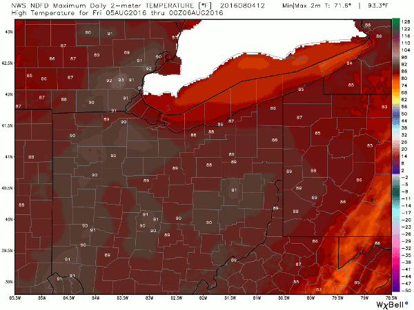
Hot and humid on Friday with afternoon temperatures climbing to the low 90s – depending on the amount of sun. And, with dew points rising to the low 70s, it will be very humid and muggy. The heat and humidity won’t stay, though. A cold front is set to cross tomorrow night that will knock temperatures back a few degrees. The dryer air behind the front will also bring relief from the humidity for the weekend.
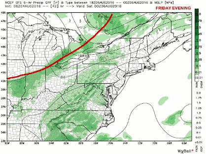
A cold front is set to cross tomorrow night that will knock temperatures back a few degrees. The dryer air behind the front will also bring relief from the humidity for the weekend. Computer modeling has been fairly consistent in bringing the front through late Friday night and as such, with weaker instability. Since the front will cross our area after peak instability has diminished I don’t think severe storms will be an issue for us.
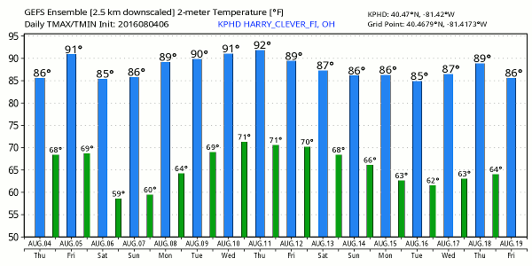
NEXT WEEK
A ridge of high pressure across the eastern US should keep the prospects for dry and warm weather through mid week. A few upper level disturbances riding along the outer edges of the ridge could bring the chances for showers and thunderstorms back into the forecast by mid week. With increasing temperatures, moisture and instability, I would expect scattered showers and storms for the second half of next week.